

Lathkill Dale & Magpie Mine
- Matt Spence
- Mar 21, 2024
- 3 min read
We recently visited Lathkill Dale and completed a 14km loop that included the Dale as well as the Magpie Mine.
Plenty of photography opportunities were had.
I planned the route using the free mapping layer within the OS App. I find this to be a really useful free tool with the added bonus that when you buy a paper map you can add the digital version to your app library.
Images below show the route and the elevation profile. I have shared the route as public on the app so if you want to follow the same route as us you can.
Start
The route starts at a car park to the east of Monyash which hosts the luxury of an actual toilet block (maintained by the village using donations)!
Straight out of the start the walk is in the Dale, started close to the top of the Dale where it is fairly open and shallow (a few limestone outcrops are still present).
On the particular day we visited the morning was very foggy and created a moody, low visibility vibe.

The Oak
A few hundred meters into the walk this lovey oak came into view.


At this stage I grabbed the drone out of my bag; but the fog was just a little too thick for me to get a great shot.

We ventured deeper into the Dale with the fog showing some signs of lifting. This next section of the Dale has vertical cliff sides and trees creating a tight path with lots of moss.

We crossed a stile and the valley widens and the trees stop. The sun had finally broken through the fog resulting in a completely different feel to the Dale.


The next point of photographic interest was the Lathkill head cave. The river issues from the southern valley wall in a small cave. Here I took the opportunity to crack out the ND filter and attempt some long exposures of the issue.


By now the sun had well and truly burnt off the fog and we enjoyed the open valley and catching some rays.
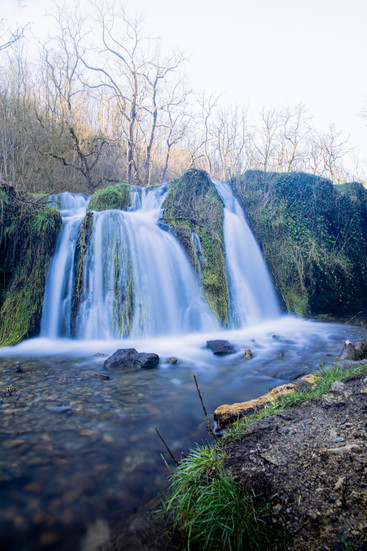
A few river wiggles and we came across a small waterfall in the river, which of course led to another break.


Mandale and Lathkill Dale mines
The final portion of the dale that we walked had many visible legacies of the lead mining that had been undertake in the valley up to the late 1800's.
This includes the ruins of the pump house which lifted water up to the Lathkill Sough which drained the workings.


From here we headed north and climbed out of the dale at Over Haddon. A good few kilometres of farmland took us to the high point of the walk at a breath taking 340m AOD.


Magpie Mine
A quick down and up leads to Magpie Mine.
Magpie Mine was the last operational lead mine in the UK closing in 1954 after first being recorded to be worked in the 1740's. It's currently privately owned but free public access to the site is maintained by donations and grants.


Leaving Magpie Mine behind the route headed west and dropped back down towards Monyash.
A short road connection led to the very top of Lathkill Dale, which we followed back to the car.


I hope you get an opportunity to visit this amazing dale! Leave comments to share anything I missed.
Will you try this route?
Yes
No
Already done it
Comments